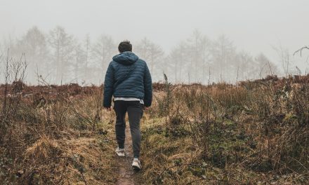
One of the best things about living in East Sussex is the abundance of countryside in which the walker can find peace and quiet. The coastline, the High Weald, the Ashdown Forest, and the majestic landscape of the South Downs all provide opportunities for escape from normal life and routine.
Chocolate box villages, a river valley, flint cottages, chalk downland, a bit of forest, and some astonishing views down to the sea all feature in my favourite East Sussex walk, the first half of which follows the South Downs Way.
I’m not going to pretend this six-mile walk is easy, indeed it features a few pretty tough uphill sections. But it’s a journey that takes you from Alfriston down the Cuckmere Valley to Exceat and back. To enjoy it properly you should allow at least four hours.
Nowadays it’s a glorious and peaceful venture into the best countryside East Sussex has to offer but the history of smugglers using this valley to secretly transport goods in from the sea hangs heavy in the air.
Step One – Alfriston to Litlington
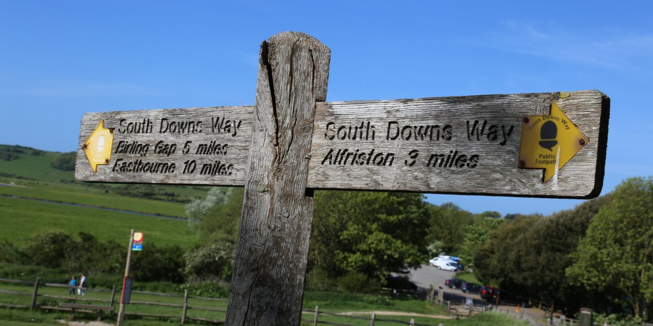
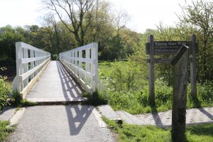
At the start resist the temptation to linger in Alfriston with its atmospheric shops, tea rooms, pubs and flint cottages, as there will be time for all of that upon your return. Instead take the path to the left of the church that leads down towards the river and cross a white pedestrian bridge to a footpath the other side. A sign invites you to follow the South Downs Way to Exceat. As you begin your walk down the valley towards the sea watch out for livestock, especially cows, which are often to be found grazing in these lush fields. And if they have calves with them, take special care.
Follow this clear route for approximately a mile along the winding river bank until the path splits. Keep left, still following the South Downs Way, and you’ll arrive in the Saxon village of Litlington. It’s reported that Maria Fitzherbert, mistress of George IV, lived at Clapham house in the village. The first pub and refreshment options present themselves in Litlington, and Tripadvisor reviews would suggest the Plough and Harrow is definitely worth a detour.
Step Two – Litlington to West Dean
Carry on through the village to the end of the high street where the road turns sharp right. Don’t follow the road but take a slight turn to the left and you will see the village hall. Take the South Downs Way path signposted to the left of the building.

A seriously deep breath is needed here because the path steepens considerably over a couple of fields until you eventually reach a high point with a large downland farm on your left, marked as Clapham Barn on the OS map. Follow the South Downs Way straight ahead as its follows the hedgerow downhill towards a small woodland, with Charleston Manor marked on the map. Turn left at the bottom of this path then don’t miss a fork to the right after a few metres.
This path takes you up another steep uphill into the Forestry Commissions’ Friston Forest. The forest is criss-crossed with footpaths and, on another day, is well worth exploring. It’s almost 2,000 acres of woodland, mainly beech, and home to a wide range of animal and plant species.
On our walk, though, as you emerge from the woodland onto a wide track (and catch your breath) keep on the main path, ignoring large pathways to the left, the right and then the left again. You will come to a fork in the path and you should keep left (still the South Downs Way) making your way down a path behind some houses to a sharp right turn.
Step Three – West Dean to Exceat
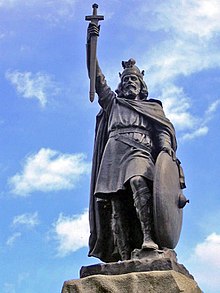
Follow the track down into West Dean and continue straight through this small village. You would never guess it now, given West Dean’s sleepy quietness, but King Alfred the Great had a palace in the village, and it is possible this was one of his naval main bases in his war with the Vikings!
It’s the South Downs Way path you need to take out of the village and it’s easy to spot as long as you don’t deviate off your straight path. You’ll see an information point behind a green vehicle gate beside the pond. The path is directly ahead and ascends through more woodland. The climb up is long and tiring but is made easy by built-in sleeper steps and is, I absolutely promise, worth the effort and exercise.
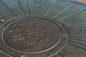
When you emerge from this woodland climb you will see a flint wall and, beyond it, the reward for all your effort is laid out in front of you. Take time to enjoy one of the most iconic views in the county as, standing on the Downs, you look down on the meanders of the Cuckmere River below.

Those meanders, as geographers will tell you, were formed by the flow of the river as it eroded and deposited parts of the river bank. But the meanders are a snapshot of history because in 1847 a straight cut was put in the river (look over towards the pub and you will see it) which effectively diverted any flow from the meanders and instead sent it straight up to the sea. Pause on the bench to catch your breath and drink in this astonishingly beautiful scene.
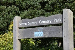
The path down is a welcome respite after your exertions and it takes you down to the Seven Sisters Country Park Centre at Exceat (pronounced Ex-seat) where you can learn a bit more about the flora and fauna of this remarkable area, and also have a welcome loo stop. Until the 14th century, Exceat was an important village with its own church but the village suffered French raids and was effectively abandoned by the 15th century.
Step Four – Exceat to “High and Over”
At this point in the walk you have a choice. For the more active and ambitious there is the option of crossing the road and following the South Downs Way, or the made up path, down to the sea. It’s definitely worth a walk and you are pretty much guaranteed the sight of wading birds, little Egrets, and the distinctive continuous twittering sound of skylarks overhead. But you’ll be adding at least three miles to your walk.
If you choose not to take this extension turn right and follow the footpath beside the road towards the Cuckmere Inn. As you do so look out for kayakers and paddleboarders enjoying the river on the left, perhaps taking lessons from the Watersports Centre, Buzz Active, at the river’s edge.
Take care on the footpath as this is a busy road and as you head towards the pub look out for the path on the right just before the small road bridge. You need to take this path to begin your journey back along the river towards Alfriston. So, heading north again, you should be following the river and on the right-hand bank. You will have lovely views of the hillside on your left as you pass Ewe Down and Brock Hole Down.
If the tide is low and the mudbanks are exposed look out for a variety of wading birds including the easy to spot Redshanks (bright orange/red legs) and herons. The journey is now an easy one beside the river but be sure not to miss the huge white horse cut into the chalk hillside at “High and Over”, on your left after about a mile.
Step five – High and Over to Alfriston
Past the white horse you’ll soon come to a bridge, New Bridge. Cross here and continue your walk on the left bank of the river. Of course, if you have a bit of excess energy, you could go backwards on this path for a diversion up to the white horse and High and Over. Once again there is quite a climb but that investment of energy will be richly rewarded with a spectacular vista capturing pretty much your entire route.
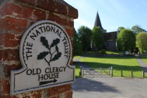
Back on the path head north again towards Alfriston, which soon becomes easily visible in the distance thanks to its church spire. As you approach the village take some time to appreciate the Old Clergy House on your left – the first ever property bought by the National Trust in 1896. This rare 14th-century thatched, timber framed Wealden hall-house is in an idyllic setting, with views across the River Cuckmere, and surrounded by a delightful, tranquil cottage garden full of wildlife.
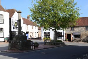
The start and finish – Alfriston village
Arriving back in the village you have a choice of pubs and tea rooms in which to rest your legs and reflect on the marvellous walk you have just enjoyed. The famous hymn, Morning Has Broken, written by Eleanor Farjeon in 1931 was apparently inspired by the beauty of Alfriston – and it’s easy to see why as the village is quintessentially beautiful. Incidentally, the origin of name of Alfriston comes from the original name for the settlement, Aelfric tun, which meant the ‘farmstead of Alfric’ in Anglo Saxon times. And I was always told it should be pronounced “all-friston” not “Alf-friston”.
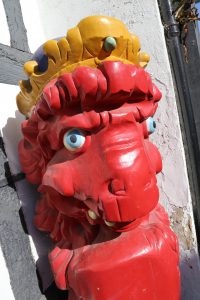
Amongst the many picturesque buildings surrounding you one of particular historical importance is the Star Inn. Originally a religious hostel built in 1345 it was used to accommodate monks and pilgrims en route from Battle Abbey to the shrine of St Richard, patron saint of Sussex, at Chichester Cathedral. It became an inn in the 16th century and opened its doors to a very different type of clientele as the infamous Alfriston smuggling gang used it as a base. Outside the Inn is a red Lion, once the figurehead of a Dutch ship which was wrecked in the 1800’s.
Final thoughts
I have enjoyed this walk dozens of times and every time I see or hear something new. Never has it disappointed. It’s not a long walk; you will have travelled just over 6 miles, but the tough uphill sections test the lungs. But it’s the history and variety that make this walk so special – at the end you will have experienced the countryside, landscape and wildlife of a river valley, much of which has not changed in a thousand years. You will have enjoyed some iconic East Sussex views and glimpsed the sea. The walk is a delight for the senses and, for me, sums up the astonishing county we live in.
More information
If this has whetted your appetite to get out in the amazing countryside of East Sussex you can get more information on walking in the county, including a comprehensive map of the county’s rights of way, some suggested circular walks, and details of guided walks, at: https://www.eastsussex.gov.uk/leisureandtourism/countryside/walks
The historic Alfriston village, the starting and finishing point for this walk, is about as beautiful as you can get. For more information about the village visit https://www.alfriston-village.co.uk/
For more information about the South Downs Way, which you will follow on this walk, visit https://www.nationaltrail.co.uk/south-downs-way
If you want more ideas for things to do in and around the Cuckmere Valley, visit https://www.nationaltrust.org.uk/features/things-to-see-and-do-at-cuckmere-valley
To learn more about the village of Westdean and its links with King Alfred, visit http://orig.villagenet.co.uk/?v=west%20dean_east%20sussex
For more information about the Seven Sisters Country Park, visit: http://www.sevensisters.org.uk/page29.html
If you fancy hiring a paddleboard, a kayak, or having a lesson on the picturesque Cuckmere River meanders, visit: https://www.buzzactive.org.uk/locations/buzz-cuckmere/
The Alfriston Clergy House was the first building bought by the fledgling National Trust. Find out more at https://www.nationaltrust.org.uk/alfriston-clergy-house